Israel Geography – All You Need To About The Israeli Geography

Israel is located in the center of the world as mentioned in the ancient maps and, the holy land is an amazing place to visit, this article will provide you all the info about the geography of Israel and many more useful facts.
THE BORDERS OF ISRAEL AND SIZE

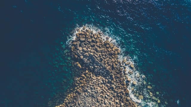
In the north, it borders on Lebanon, in the northeast - with Syria, in the east - with Jordan, in the southwest - with Egypt. In the south, there is the Red Sea (coastline - 12 km).
The length of the country from north to south is 470 km, from east to west at its widest point - 135 km. The total length of Israel's borders is 1125 km.
The area of Israel within the borders and ceasefire lines, including the territory of the Palestinian Authority, is 27.8 thousand km², of which 6.22 thousand km² are in Judea, Samaria, and the Gaza Strip, occupied by Israel during the 1967 war.
PHYSICAL-GEOGRAPHICAL AREAS OF ISRAEL
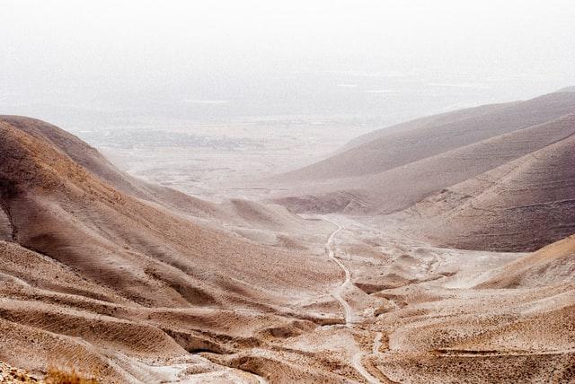
Israel is usually subdivided into four physical-geographic regions: the Coastal Plain, the Central Hills, the Jordanian Rift Valley, and the Negev Desert.
ISRAELI COASTAL PLAIN
The coastal plain stretches along the Mediterranean Sea from the border with Lebanon in the north to the Gaza Strip in the south and is interrupted only by Mount Carmel on the Haifa Bay. This plain is quite narrow, from 5 km near the border with Lebanon to 40 km in the Gaza Strip. The coastal plain, quite fertile and humid, has historically been dangerous due to malaria. Citrus and grapes are widely grown here. The plain is crossed by several short streams, of which only two have a constant flow: Yarkon and Kishon.
This area is usually divided into five distinct sections. Western Galilee stretches from the settlement of Rosh Hanikra in the north to the city of Haifa in the south. It is a fertile area; The coastline of the Haifa Bay is very indented, with numerous small islets nearby. The rest of the coastline is weakly indented and lacks natural harbors. South of Haifa, there is the Hof HaCarmel region (Carmel Plain), which stretches in a narrow strip (1-4 km wide) to the city of Zichron Ya'akov.
To the south is the Sharon Plain, stretching towards the Yarkon Stream and the city of Tel Aviv; it is a densely populated area of Israel. To the south, the Central Coastal Plain extends to the settlement of Nahal-Shikma. The southernmost part of the coastal plain extends to the Gaza Strip and is known as the Shfela, Judean Plain, or Western Negev. The northern part of this site, Visor, is covered with savannas and is quite densely populated, while the southern part, Agur-Khalutsa, is very rarely inhabited.
CENTRAL HILLS
There is a strip of mountains and hills to the east of the Coastal Plain. In the north, these mountains form a plateau (highland) of Galilee (which, in turn, is divided into upper and lower) - an elevated plain with an average height of 600-700 m, the maximum point is Mount Meron (1208 m).
The mountains have a folded-block structure, however, folding is not very pronounced in the relief. The greatest influence on the formation of the relief was exerted by late geological processes, primarily faults, and blocks. The steep slopes of the massifs in many areas are cut by narrow and deep valleys.
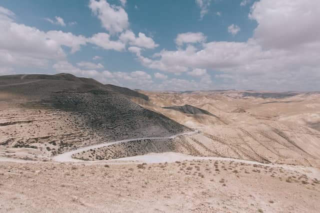
To the south of Galilee, in the West Bank of the Jordan River, lie the hills of Samaria, about 800 m high, separated by numerous fertile valleys such as Jezreel. South of Jerusalem, also in the West Bank, is the Judea Hills, including Mount Hebron. The height of these hills is on average 610 m.
JORDAN RIFT VALLEY

To the east of the strip of central hills lies the Jordan Rift Valley, part of the Great Rift Valley, stretching 6,500 km from Syria to East Africa. In Israel, the valley contains the Jordan River, the Kinneret (an important source of fresh water in the region), and the Dead Sea. The Jordan River is the largest in Israel, its length is 322 km. The river begins at the confluence of the Dan, Banias, and Hasbani rivers at Mount Hermon in the Anti-Lebanon ridge and flows south through the Hula Valley to the Sea of Galilee, located at an altitude of 213 m below sea level. The sea has a volume of about 3 km3 and serves as the main reservoir for the National Water Pipeline.
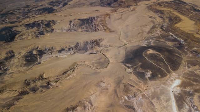
To the south of this lake flows the Jordan River, forming the state border between the West Bank and Jordan, and flows into the very salty Dead Sea, surrounded in the west by the Judean Desert. The Dead Sea is located 420 m below sea level - it is the lowest point on land in the world. South of the Dead Sea, the rift valley continues in the form of the Arava valley, in which there are no permanent rivers, to the Gulf of Aqaba in the Red Sea.
NEGEV DESERT
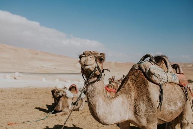
The entire southern part of the country is occupied by the Negev Desert, covering an area of 12 thousand km² - about half of Israel's territory. Geographically, the Negev, an extension of the Sinai Desert, forms a large triangle with a base along the line between the city of Beer Sheva, the Dead Sea and the hills of Judea, and with a summit near the city of Eilat at the southern end of the country. A unique feature of this area is several crater-like formations - "makhtesh": Makhtesh Ramon, Makhtesh Gadol, and Makhtesh Katan.
The desert overlaps slightly with other topographic regions of the country, including the lowlands in the east, the hills in the center, and the Arava Valley in the west. Often, five ecoregions are distinguished on its territory: the northern, western, central Negev, the highlands, and the Arava valley. The northern Negev receives about 300 mm of rainfall annually and has relatively fertile soils. The western Negev receives about 250 mm of rainfall, and its soils are more sandy. The central Negev receives about 200 mm of precipitation, the soils are dry, impervious to water, which is why soil erosion is more significant. The Ramat HaNegev Highlands are located between 370 and 520 m above sea level, with winter and summer temperatures at their most extreme. This area receives about 100 mm of precipitation annually, the soils are poor and saline. The Arava Valley on the border with Jordan is dry, with about 50 mm of rainfall annually.
GEOLOGICAL STRUCTURE OF ISRAEL
Israel is divided from north to south by a ridge that runs parallel to the coast; Jerusalem is at the top of this ridge. From the east, the country is bordered by a large graben, which led to the formation of the Jordan Rift Valley.
The country's territory is formed mainly by rocks of the Mesozoic, Tertiary, and Quaternary systems. The most widespread are Upper Cretaceous deposits, represented by limestones, marls, and dolomites, with a thickness of up to 750 m. Tertiary deposits (limestones and sandstones) are widespread in the coastal part and on the Galilee plateau. In the Israeli part of the Jordan Valley, there are powerful alluvial formations. In the north, off the coast, there are also significant chalk deposits from which formations such as Rosh Hanikra are formed.
Along with the limestone layers, a large amount of water flows to the east, forming several springs near the Dead Sea, around each of which an oasis has arisen - in particular, the inhabited oases of Ein Gedi and Ein Bokek.
Since limestones are easily eroded by water, karst processes have developed widely in these layers. Although there are many karst caves, only one is open to visitors. Also on the territory of Israel, there are many small natural caves, historically used as shelters, warehouses, meeting places.
THE CLIMATE OF ISRAEL

Israel's climate is subtropical Mediterranean type, with dry hot summers and mild rainy winters. In summer, tropical air prevails, in winter it alternates with air masses of temperate latitudes. The relief significantly determines the variety of climatic conditions in different regions of the country.
The average annual rainfall drops sharply from west to east and from north to south: from 1,000 mm in the Upper Galilee to 30 mm in the Eilat region and 500 mm in the central regions to 50 mm on the coast of the Dead Sea. The largest number of rainy days occurs in January-February. During these months, the average relative humidity is 72%, while in June it is 47%. Thunderstorms are rare, on average 7 days a year.
The average annual temperature on the Mediterranean coast is 20 ° C, in mountainous areas it drops to 15-16 ° C. The southern part of the country has the hottest climate, where the average annual temperature exceeds 22 ° C, and the average temperature of the hottest month is 30 ° C. In winter there are negative temperatures; the absolute minimum temperature reaches -4 ° C at an altitude of 750 m.
In the central regions of the country, at an altitude of about 750-800 m, with an average annual temperature of 17 ° C, average monthly rates range from 9 ° C in January to 24 ° C in August. Here, for more than 300 days a year, temperatures are kept above 15 ° C, and for 160 days - over 25 ° C.
WINDS IN ISRAEL
Basically, the winds are northerly and westerly: northern and north-western winds blow in summer, northeastern in winter. In spring and early summer, a hot and dry Khamsin wind blows from the south and southeast, which greatly increases the temperature and dryness of the air and negatively affects the vegetation. There are dust storms in the Negev (12 days a year on average).
HYDROGRAPHY OF ISRAEL
Freshwater resources in the country are estimated at 1,800 million m³ per year, of which 1,100 million m³ come from small rivers and springs, 320 million - from the Israeli part of the Jordan, 200 million - from the Yarkon River Basin drainage. Freshwater is also obtained by desalination of seawater and wastewater treatment.
The main reservoir of the country's water supply system is the Sea of Galilee (about 4 billion m³), from which there is a 142 km water pipeline to the city of Rosh HaAin, where it is connected to the Yarkon-Negev water pipeline (109 km). The few rivers in the western part of the country belong to the Mediterranean basin, most of them dry up during hot seasons. The eastern part is brainless.
JORDAN RIVER
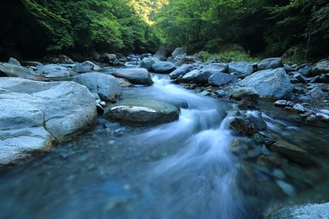
In the northeast, at the bottom of the El Gore graben (that is, the Jordanian Rift Valley) flows the country's most permanent river, the Jordan, which originates from the Hermon massif. Jordan flows through the Hula Valley, flows through Lake Tiberias, and empties into the Dead Sea. Between the Sea of Galilee and the Dead Sea, its largest tributary, the Yarmouk River, flows into the Jordan. From the Hula Valley to the Sea of Galilee, the Jordan flows in a narrow basalt gorge and has a significant slope (1.2 ‰). The rest of the way it flows through an alluvial plain, which sometimes floods, forming numerous meanders. Thanks to hydraulic structures, the river has an almost constant flow (except for short floods).
SEA OF GALILEE

The Sea of Galilee has several other names - Lake Tiberias, Lake Gennesaret, Lake Kinneret. With a length of 21 km and a width of 12 km, the lake has a depth of 48 m. The height of the mirror is about 220 m below sea level. Despite the slight salinity, its waters are drinkable and rich in fish.
THE DEAD SEA
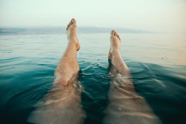
The Dead Sea covers an area of approximately 1,000 km², with a length of 76 km and a width of 16 km. Of the total area of Israel, it owns a plot of 250 km². The sea is a closed salt lake. Due to the lack of runoff and high evaporation, the content of salts (magnesium chloride, sodium chloride, and others) in the water reaches 22% at the surface and 33% at depth.
THE SOIL OF ISRAEL
In the western part of the country, which receives a sufficient amount of rainfall, that is, on the coast and the slopes of the mountains, brown soils prevail, typical of dry subtropical forests and shrubs. In the central and eastern regions, mountainous gray-brown soils are widespread, in the south - soils of subtropical deserts. In some areas in the north of the Negev Desert, located near the Coastal Plain, fertile layers of loess have formed. The soils of the Galilee are composed of limestone, while the soils of the southern Negev are composed of sandstone and granite. Some mountainous and desert areas have no soil cover. In the coastal zone, the humus content in the upper horizon (up to 10 cm) reaches 2.4%, and at a depth of 1 m - up to 0.75%
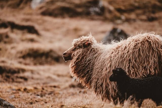
THE ANIMALS OF ISRAEL
The fauna of Israel has about 100 species of mammals, 500 species of birds (of which more than half live permanently in the country), the rest are migratory. Almost 100 species of reptiles, of which about 30 species of snakes, 7 species of amphibians.
The fauna of Eretz Israel in antiquity was much richer, several species of large mammals - the lion (disappeared in the 13th century), the Syrian bear (extinct in the 19th century), the Berber ram, oryx, fallow deer, onager, as well as the owl and the Nile crocodile (exterminated in early XX century) - disappeared as a result of the destruction of forests or were exterminated by man. But there are still such species: badger, one-humped camel, gazelle, maned ram, antelope, Nubian ibex, oryx, wild boar.
Turtles are widespread: land (Latin Testudo Ibera) and marsh (Latin Clemmys Caspica), and exclusively in the Alexander River, there are Nile soft-skinned turtles (Latin Tionyx Triunguis).
There are over 30 species of snakes in Israel, of which eight are venomous. The Palestinian viper (Vipera Palestine), EFA (Echis Colorata) are widespread. Lizard snake (Malpolon Monspessulanum), the bite of which, fatal to small animals, is not dangerous to humans. One of the most common non-venomous snakes is the boa snake (Eryx), the water snake (Natrix tesselate), the black or Syrian snake (Coluber Jugularis), and the spotted pseudo-snake (Coluber Mummifer).
Until the beginning of the 20th century, the Nile crocodile (Crocodilus Niloticus) was found in the rivers flowing into the Mediterranean Sea. American alligators have been brought to several farms for commercial purposes.
Amphibians in Israel due to the dry climate are represented by a limited number of species. Among the tailed amphibians are the fire salamander (Salamandra salamandra) and the Asia Minor newt (Tritonus Vittatus). Tailless amphibians are represented by tree frogs (Hyla Arborea) and green toads (Bufo viridis) and Syrian toads (Pelobates Syriaca).
Until the twentieth century, a rare black-bellied disc-tongued frog, also known as the "Palestinian motley frog," was found in British Palestine, which was declared extinct in the early twentieth century. But in November 2011, Israeli biologists discovered a specimen of this frog in the Lake Hula nature reserve, and the next year it gave birth; however, not many.
Over the past 60 years, due to the increase in the area of green spaces, the chameleon has spread.
586 fish species inhabit the waters of Israel. Dolphins and dugongs are found in the Mediterranean and Red Seas. Of the land invertebrates in Israel, arthropods are numerous, primarily insects. In total, there are tens of thousands of species in the country.
The territory of Israel serves as an intermediate point on the route of migratory birds from Northern Europe and Asia to Africa and back.
In May 2008, the Ministry of the Environment announced an unofficial “national bird election”. The hoopoe was chosen, leaving the warbler, goldfinch, and songbird in the second, third, and fourth places.
VEGETATION OF ISRAEL

In Israel, there are representatives of three vegetation belts, the border of which converge exactly here: the Mediterranean, Iranian-Turanian, and Sahara-Sindian. Which are represented in the country by 2600 plant species belonging to approximately 700 genera, belonging to 115 families. Of these, 150 are found exclusively in Israel.
The country has established national parks, as well as about 160 nature reserves and landscape reserves. As of July 2007, Israel had 41 national parks.
70% of Israel's modern forests were planted in the 20th century. In 1948, there were about 4.5 million trees in the country, and at the end of the 1990s. - more than 200 million. Israel is almost the only country in the world where the green area is not decreasing but increasing.
Forest areas are found in Galilee, Samaria, the Judean Hills, and the Carmel mountain range. 60% of Israel's territory is desert, of the remaining 40%, more than half is rocky soil of hills and mountainous regions.
The most common trees: cypress, olive, oak, carob, sycamore, fig, laurel, myrtle, pomegranate. Planting of eucalyptus is quite widespread.
Since 1965, the Department for Nature Protection has been operating, which monitors the conservation of landscapes together with the Society for the Protection of the Environment.
In forest plantations, alpine pine, acacia, and eucalyptus are most often planted, while cypress, casuarina, ficus, tamarisk, oleander, and pistachio are used for landscaping settlements.
ORDER NOW!

SLAVA BAZARSKY
PHONE: +972 53 4779797
Tours in Israel
- 11 Days Jewish Heritage Tour through Israel
- 3-Day Israel Tour for Seniors - Walk Through the Bible
- 3-Day Jewish Heritage Tour of Israel: Unveiling the Rich Tapestry
- 4 Day Israel Tour Package for Seniors - Easy Individual Pace
- 5 Days Jewish Heritage Tour to Israel: A Journey Through History and Spirituality
- 5-Day Israel Private Tour Package For Seniors With Discounts
- 6-Days Israel Private Tour Package for Seniors
- 7 Day Jewish Heritage Tour to Israel: A Holistic Journey
- 7-Day Israel Tour for Seniors: Discovering History and Culture
- 9-Day Jewish Heritage Tour Through Israel
- Best Israel Tours for Seniors lead by #1 private tour guide
- Christian Holy Land Guided Tour of Israel 2026
- Classic Guided Israel Tour
- Holy Land Tours For Seniors From The USA With Price And Reviews
- ISRAEL: OFFICIAL TOURING ENTRY FOR FAMILIES, SMALL GROUPS COVID 19
- Jewish Heritage Guided Tour
- Volunteer and Solidarity Trips to Israel | 2026/2027 Mission Tours
Daily Tours in Israel
- BATTLE LEGACY TOUR
- Best 3-Day Negev Jeep Tour - Mystery of The Israeli Desert
- Best Eilat to Petra 1 Day Private Tour
- BETHLEHEM AND JERICHO PRIVATE DAY TOUR FROM JERUSALEM & TEL AVIV
- CALIBER 3 GUSH ETZION - ULTIMATE ISRAELI MILITARY ADVENTURE
- CHRISTIAN GALILEE TOUR
- CHRISTIAN JERUSALEM TOUR
- CITY OF DAVID AND UNDERGROUND JERUSALEM TOUR
- CLASSIC PRIVATE JERUSALEM TOUR
- Dead Sea and Masada Private Guide Day Tour, Reviews & Price
- Dead Sea and Masada Private Guided Tour for Seniors
- Dead Sea Relaxation Day Tour
- HAIFA, AKKO AND ROSH-HANIKRA TOUR
- Half Day Tour To Bethlehem From Jerusalem With A Local Guide
- Jerusalem Private Tour for Seniors with Cost & Reviews
- Jerusalem Rooftops And Walls Private Tour: History From A Different Angle
- JORDAN RIVER BAPTISM SITE TOUR
- Judean Desert Area Private Tour - Hiking and Off Road Jeep
- Kibbutz Beeri Solidarity Tour - Support and Volunteer
- Kibbutz Nir Oz Solidarity Tour - Witness October 7th Dark Events
- Levinsky Market Ultimate Tasting Private Tour
- Northern Israel Solidarity Tour: Kiryat Shmona, Kibbutzim & Golan Heights
- October 7th Gaza Envelope Memorial Tour from Tel Aviv | Bear Witness
- Private Tour to Nazareth and Capernaum for Seniors
- Private tours of Acre, Caesarea and Haifa from Tel Aviv Israel: Reviews, Price
- Private Tours of Jerusalem and Bethlehem from Tel Aviv Israel: Reviews, Price
- Private Vip Tour Of The Israel Diamond Exchange Center in Ramat Gan
- RAMAT GAN SAFARI PARK TOUR
- SAFED AND GOLAN HEIGHTS TOUR
- Senior-Friendly Private Tour of Caesarea and Haifa
- TEL AVIV AND JAFFA PRIVATE TOUR
- Tour of the Shephelah for Seniors: Beit Govrin, Maresha, Burma Road
- Touring Nova Music Festival Site, Sderot, The Burnt Cars Compound, And Other Sites Around Gaza Strip Following The 7.10.23 Hamas Attack